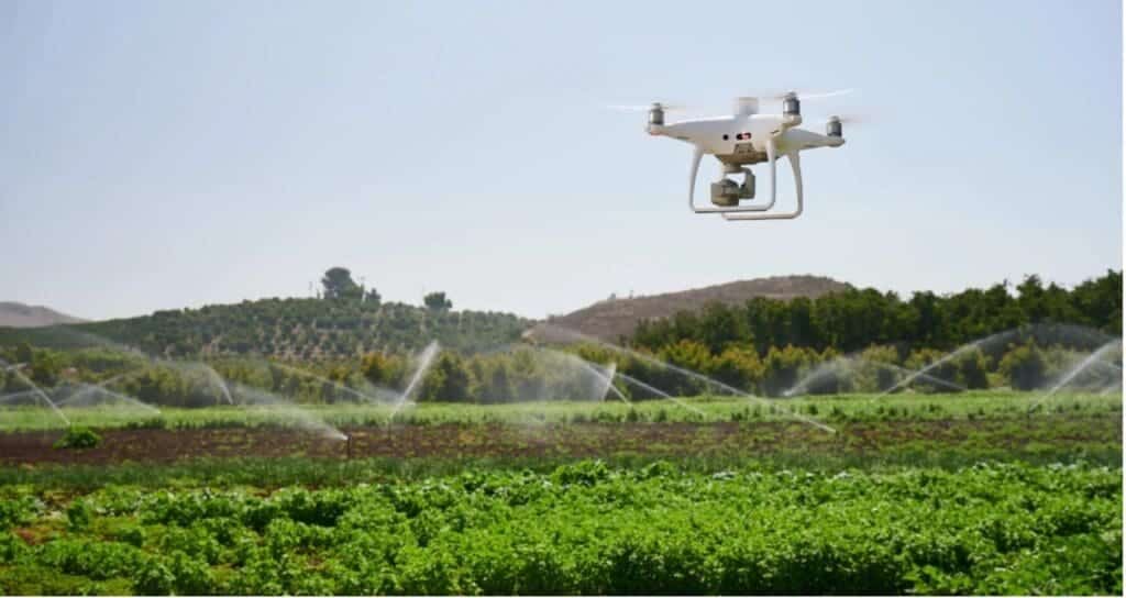
In the realm of landscape management, where efficiency is key to sustainability, innovative technologies are transforming age-old practices. Drone technology, once the domain of aerial photography and military reconnaissance, are now taking to the skies to revolutionize irrigation systems around the world. From precision monitoring to targeted interventions, these unmanned aerial vehicles (UAVs) are proving to be invaluable tools in the quest for water-wise landscape management, which is of great benefit for thirsty systems such as golf courses and sport fields. In this post, we explore how drones are ushering in a new era of smart irrigation systems, particularly focusing on their applications and benefits.
The challenge of irrigation systems in landscape management
Water scarcity is a pressing concern for land owners worldwide. In many regions, erratic rainfall patterns and depleting groundwater reserves pose significant challenges to gardening, sport fields, general landscapes, and natural habitats. Traditional irrigation methods often result in water wastage, inefficient distribution, and increased costs for land owners.
Enter Drone Technology: Aerial Eyes on landscapes
Drones equipped with various sensors and cameras are now offering a bird’s-eye view of urban and natural landscapes. This aerial perspective provides land owners with real-time data on soil moisture levels, vegetation health, and water distribution patterns.
Here’s how drones are transforming irrigation systems:
1. Precision mapping and analysis
Using advanced imaging technologies such as multispectral and thermal cameras, drones can create detailed maps of landscapes. These maps reveal variations in soil moisture content, identify areas of stress in vegetation growth, and highlight inefficiencies in irrigation practices.
Landscape managers can then use this information to create precise irrigation plans, allocating water resources only where and when needed. By avoiding overwatering and ensuring optimal moisture levels, vegetation growth can be maximized while minimizing water wastage.

2. Monitoring vegetation health
Drones equipped with multispectral cameras can detect subtle changes in plant health that may not be visible to the naked eye. They can identify nutrient deficiencies, pest infestations, and diseases early on, allowing landscape managers to take timely corrective actions. For example, if a section of a field shows signs of water stress, the drone-generated data can indicate the exact location. Land managers can then adjust their irrigation systems accordingly, directing water to the affected area and preventing vegetation loss.

3. Assessing irrigation systems infrastructure
Maintaining irrigation infrastructure, such as pipes, valves, and sprinklers, is crucial for efficient water distribution. Drones equipped with high-resolution cameras can inspect these systems from the air, detecting leaks, blockages, or malfunctions.
Early detection of such issues allows landscape managers to address them promptly, reducing water losses and the need for costly repairs. Regular drone inspections also contribute to the longevity and effectiveness of irrigation systems.

4. Enhancing water conservation
By optimizing irrigation practices based on drone-collected data, landscape managers can significantly reduce water usage on their fields. This not only conserves a precious resource but also contributes to the sustainability of landscape management in water-stressed regions.
Additionally, drone technology helps in the implementation of precision irrigation techniques such as drip or micro-sprinkler systems. These methods deliver water directly to the roots of plants, minimizing evaporation and runoff.
5. Cost-effective and timesaving
Implementing drone technology in irrigation management offers a cost-effective solution for landscape managers. While initial setup and training costs may be involved, the long-term savings in water, labour, and vegetation growth loss outweigh these investments.
Moreover, drones can cover large areas in a fraction of the time it would take traditional methods, such as manual inspections or satellite imagery analysis. This efficiency allows managers to make informed decisions swiftly, responding to changing conditions on the ground.
Conclusion
As the world grapples with economic and environmental challenges, the role of drone technology in landscape management becomes increasingly vital. Drones, with their ability to provide real-time data, actionable insights, and precise interventions, are proving to be transformative tools in improving irrigation systems.
By empowering land owners and managers with the information they need to make informed decisions, drones are not just optimizing water usage but also decreasing operational expenses and promoting sustainable ecological landscape practices. As we look towards a future of resilient landscape management, these aerial guardians are at the forefront, ensuring that every drop of water counts in nourishing our fields and conserving natural resources.
